The volcano under the ice
Katla volcano: facts and safety
Where Katla is, how often it erupts, how it is monitored and what that means for a trip to Vík and the ice cave, from Icelandic Met Office pages.
Check dates and availability ↗Quick answer
Katla is an active volcano buried under the Mýrdalsjökull ice cap in south Iceland, north of Vík. Its last major eruption began in 1918. The Icelandic Met Office watches it around the clock, and nobody can say when the next eruption will come. If you're visiting Vík or the ice cave, check the Met Office and Safetravel before you travel, and follow local instructions.
Where Katla is
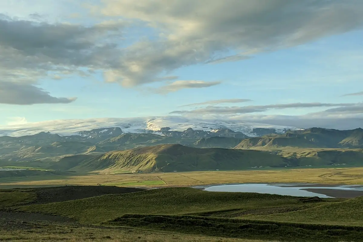
Katla lies beneath the Mýrdalsjökull ice cap, north of Vík í Mýrdal and east of Eyjafjallajökull. Its highest point is 1,512 metres above sea level. A caldera about ten kilometres across is covered by between 200 and 700 metres of ice. Because the volcano is buried, you never see Katla itself, only the ice cap on top of it. Wikipedia says the name probably comes from the Icelandic word for kettle.
How often it erupts
The Icelandic Met Office counts at least 21 eruptions in the last 1,100 years, an average of about one every 50 years. Most were explosive, with ash plumes and glacial floods. The last major eruption began on 12 October 1918, and the Met Office has called the gap since then unusually long compared with recent centuries. It also says the next eruption is difficult to forecast, so no date can be given. Wikipedia describes a normal gap of 40 to 80 years, which gives the same sense of scale. The same volcanic system includes Eldgjá, a long fissure whose eruption around 939 CE the Met Office lists as the largest of the lava-forming eruptions.
What an eruption would do
Katla sits under a thick ice cap, so an eruption melts ice quickly. The result is a glacial outburst flood, called a jökulhlaup, that runs out from under the glacier. The Met Office says floods from Katla's past eruptions have inundated Mýrdalssandur, the plain the super jeeps cross to reach the ice, and Wikipedia says a flood would most likely drain toward Vík. Eruptions also produce ash. This is why Katla is among Iceland's most closely watched volcanoes, and why a warning system matters more than a fixed date. The flat black plain you cross on the way to the ice is a record of that history: Wikipedia calls Kötlujökull the usual path for floods that reach the plain and the sea.
How Katla is watched
The Met Office monitors Katla around the clock. It uses seismometers, GPS, strain meters, satellite radar, hydrological and gas sensors, infrasound, webcams and surveillance flights, and says it aims to issue a timely warning if an eruption begins. It expects to see signs before an eruption, such as more earthquakes, swelling of the ground, or changes in gas and water readings. Its published monitoring pages are the source to trust for current conditions, not old headlines.
Earthquake headlines
Quake swarms at Katla make the news. The Met Office says rises in seismicity in summer are common there, and are often linked to meltwater draining from the ice. In 2016 it said a swarm did not show signs of an imminent eruption, though it could not rule out a sudden escalation. It also advised travellers not to spend time near the upper Múlakvísl river, where gas measurements near its source showed unhealthy hydrogen sulphide levels. Check current notices before you go. A headline about a swarm is a reason to look at the Met Office pages, not a reason to cancel on its own.
Is the ice cave trip safe?
On the day, the risks on the tour are glacier risks, not volcano risks. Safetravel says crevasses can appear with limited warning and that weather on a glacier can be more unforgiving than elsewhere. That is why the trip is guided: Visit Iceland says never to walk onto a glacier without a qualified guide. Natural ice caves can also collapse, so the guide decides which cave is safe to enter. The walk is beginner-friendly and no experience is needed. If conditions are poor, a departure can change, so read the cancellation terms when you book.
Read next: Ice Caves, Guides and Why They Change
Seeing the ice cap from the ground
You can see Mýrdalsjökull from Route 1 near Vík, from the Dyrhólaey headland and from Reynisfjara beach. On a clear day it looks like a white dome behind green hills, with Katla hidden beneath it. Eyjafjallajökull, the ice cap to the west, is a separate volcano. A close look at the ice itself needs a guided trip. At Reynisfjara, Safetravel warns that sneaker waves can sweep an adult out to sea in seconds, so stay well back from the water and follow the warning lights.
Getting to Vík
Vík í Mýrdal is Iceland's southernmost village, on Route 1, roughly 180 to 190 km from Reykjavík by road. It sits directly south of Mýrdalsjökull and is one of the wettest places in the country. Visit Iceland calls it a good base for breaking up the drive east. Staying the night in Vík makes the tour start easier. In an emergency in Iceland, Safetravel says to call 112. The volcano doesn't change with the seasons, but conditions on the ice do: Visit Iceland puts the natural ice-cave season at roughly November to May, depending on temperature and weather, and the booking calendar shows which dates run. Our what-to-wear guide covers layers and boots.
Read next: What to Wear and How Demanding It Is
Why the cave walls are streaked with ash
The Met Office says Katla's eruptions have mostly been explosive, producing ash plumes as well as floods. Ash that falls on the ice cap can be buried by later snow and become part of the glacier. As the ice flows and melts, those layers can end up on show in a cave wall. That is why the Katla cave is described as blue ice with volcanic ash frozen inside it, a look that differs from caves in glaciers that don't sit on a volcano.
Where to check before you go
Three sources are worth bookmarking. The Icelandic Met Office publishes volcano and earthquake information, Safetravel covers conditions and warnings for visitors, and Visit Iceland's eruption page explains the colour-coded alerts in the Catalogue of Icelandic Volcanoes, where red means an eruption is imminent or underway. If you're booked on the tour, your confirmation and the operator are the final word on whether your departure is running.
- Icelandic Met Office: volcano and earthquake notices
- Safetravel: conditions and warnings for visitors
- Visit Iceland: eruption alerts explained
Who this isn't for
If the idea of a volcano under your feet would spoil the day, this isn't the right trip: Wikipedia describes the Katla area as one of Iceland's most serious natural hazard zones. Don't book it to see lava or an eruption, because Katla is under ice and its eruptions are mostly explosive and flood-producing. And if you only want a view of the ice cap, a drive along Route 1 and a stop at Dyrhólaey needs no tour.
Frequently asked questions
Where is Katla volcano?
Under the Mýrdalsjökull ice cap in south Iceland, north of the village of Vík and east of Eyjafjallajökull. The summit is 1,512 metres high and the caldera is buried under ice.
Is Katla going to erupt soon?
Nobody can say. The Icelandic Met Office says the next eruption is difficult to forecast, monitors Katla around the clock and expects to detect warning signs. Summer earthquake swarms are common and, by themselves, not necessarily a sign of an eruption. Check the Met Office website for current notices before you travel.
When did Katla last erupt?
The last major eruption began on 12 October 1918. Wikipedia lists a minor one in July 1999. Neither compares with the large eruptions in the historical record.
What does the name Katla mean?
Wikipedia says it probably comes from the Icelandic word for kettle, referring to the volcano's shape. Katla is also a female first name in Iceland.
Can I see the volcano itself?
No. Katla is buried under the ice cap. You can see Mýrdalsjökull from Route 1, Dyrhólaey and Reynisfjara, and a guided tour takes you onto the ice.
Is it safe to stay in Vík?
Many people visit and stay there. Wikipedia notes that a flood from an eruption would most likely run toward Vík, which is why monitoring matters. Check the Met Office and Safetravel for notices, and follow local instructions.
Sources
- 100 years since Katla erupted (Icelandic Met Office)
- Katla and Mýrdalsjökull (Icelandic Met Office)
- Volcanic eruptions in Iceland (Visit Iceland)
- South Iceland (Visit Iceland)
- Ice-cave exploration (Visit Iceland)
- Glacier safety and crevasse maps (Safetravel)
- Black beach safety (Safetravel)
- Katla (volcano) (Wikipedia)